Tianyi Sensor IOT Technology Co., Ltd
Sales Manager:Ms. Emily Wang
Cel,Whatsapp,Wechat:+86 15898932201
Email:info@fengtutec.com
Add:No. 155 Optoelectronic Industry Accelerator, Gaoxin District, Weifang, Shandong, China


Sales Manager:Ms. Emily Wang
Cel,Whatsapp,Wechat:+86 15898932201
Email:info@fengtutec.com
Add:No. 155 Optoelectronic Industry Accelerator, Gaoxin District, Weifang, Shandong, China

Model:FT-HWSM1
Brand:tianyi
Infrared Thermal Imaging Camera Product Introduction
Infrared Thermal Imaging Camera detects and measures infrared energy from objects and captures images of the objects by using infrared light.
1.Display screen: ≥3.5 inches, supports screen brightness adjustment, and the sampling frame rate is not less than 60 frames/second.★
2.Detector pixels: ≥384×288.
3.Temperature measurement range: -40℃~1200℃.
4.Noise equivalent temperature difference (NETD): ≤50mK.
5.Working band: 8~14μm.
6.Image mode: ≥8 types, supports white heat, black heat, fire protection, fire, search and rescue, picture-in-picture, visible light and fusion modes, and has the functions of temperature measurement value, battery consumption, temperature ruler, photography or photography status display.★
7.Zoom function: Supports 2x and 4x digital zoom.
8.It has infrared mode and visible light mode.The two modes can be switched quickly, and the visible light resolution is ≥5 million pixels.★
9.Supports the real-time viewing and saved pictures and videos of this machine, and supports the real-time deletion of video pictures of this machine.★
10.It has laser indicator function, electronic compass pointing function, hot and cold spot tracking function, and automatic tracking function of the maximum temperature and minimum temperature of the full screen, which can display the highest, lowest temperature and center point temperature at the same time.★
11.It has laser ranging function, which can measure and display the straight line distance between the measured object and the host; ★
12.Laser ranging range: ≥600m;
13.Working duration in a specific environment at high temperature: ≥30min at 80℃; ≥10min at 120℃; ≥5min at 260℃;
14.Protection level: IP67.★
15.The top of the main unit is equipped with a metal hook and a telescopic buckle, which can hang the thermal imager on the chest.The vertical load capacity of the telescopic buckle is ≥20Kg, the retraction force is ≥1.5Kg, and the telescopic length is ≥50cm.★
16.The mass of the host (including battery) is ≤800g, and the size of the host is ≤205mm*110mm*80mm.★
17.Power supply method: It is powered by a detachable lithium battery, with a battery life of ≥4h/block.The host and battery have Type-C interface, which supports charging of the unit and direct charging of the battery.★
18.Working temperature: better than the range of -20℃~+60℃.
19.Comply with the standard requirements of XF/T 635-2023 "Infrared Thermal Imager for Fire Fighting".★
20.It is necessary to have shock absorption buffer protection device to meet the 2-meter drop test;
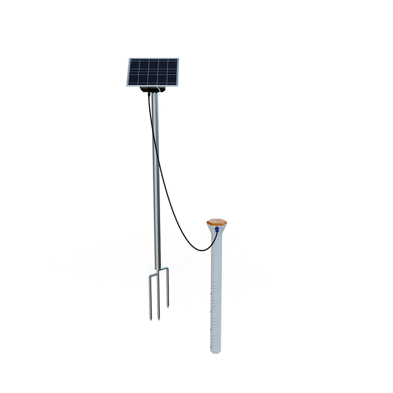
In a tea plantation base, there is an Agricultural Weather Stations for the tea garden microclimate. Composed of devices such as cameras, digital displays, and smart agricultural monitoring sensors, it serves as the "smart brain" of the tea garden.The core, Agricultural Weather Stations, c...
Visibility detector uses forward scattering to measure the total extinction coefficient of air and calculate current visibility. It can identify weather phenomena such as fog, rain, snow, mixed precipitation, and clear skies, with a recognition rate of no less than 95%. It is suitable for indu...
The problem of water pollution is serious. Governments, environmental protection agencies, and scientific research institutions need to promptly and accurately grasp the water quality status to formulate effective water resource protection and pollution control policies. However, the detection scope...
In numerous meteorological monitoring and related fields, accurately measuring wind speed and direction is of great significance. From the perspective of large-scale meteorological research, understanding accurate data of wind speed and direction helps meteorological departments better predict weath...


 Get a Free Quote
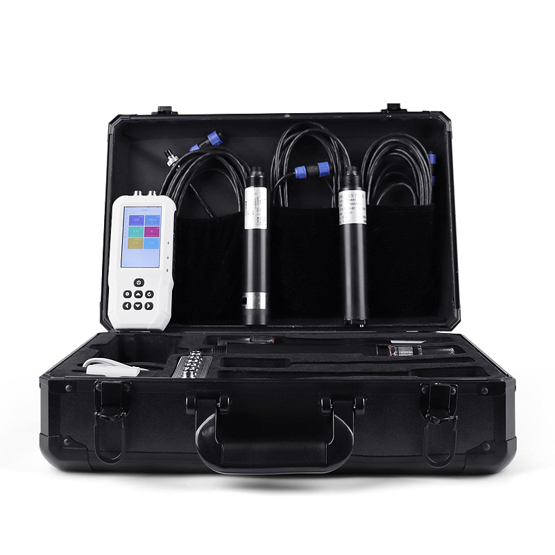
 Skype
Skype
 whatsapp
 mail
mail