Tianyi Sensor IOT Technology Co., Ltd
Sales Manager:Ms. Emily Wang
Cel,Whatsapp,Wechat:+86 15898932201
Email:info@fengtutec.com
Add:No. 155 Optoelectronic Industry Accelerator, Gaoxin District, Weifang, Shandong, China


Sales Manager:Ms. Emily Wang
Cel,Whatsapp,Wechat:+86 15898932201
Email:info@fengtutec.com
Add:No. 155 Optoelectronic Industry Accelerator, Gaoxin District, Weifang, Shandong, China
time:2025-12-17 13:10:02 source:Weather Station viewed:336 time
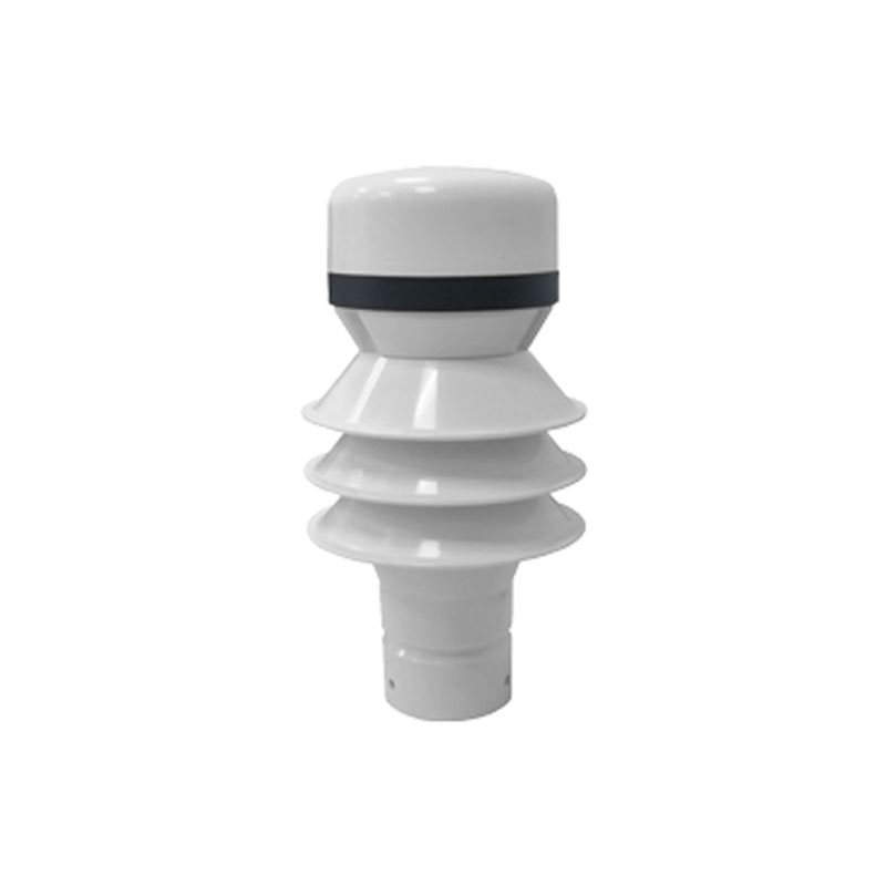
Radar rain detector is a precipitation measurement instrument that uses 24GHz Doppler radar technology. It identifies rain, snow, and hail types and measures rainfall intensity by analyzing the falling velocity and particle size of precipitation particles. Unaffected by foliage cover, it offers sensitive and rapid detection and is widely used in meteorology, hydrology, environmental protection, and flood control.
The core measurement technology of Radar rain detector is 24GHz Doppler radar detection. The device integrates a small flat-panel radar module that continuously emits microwave signals at a specific frequency. When precipitation particles (such as raindrops, snowflakes, and hail) pass through the measurement area, they reflect radar waves. The device receives the reflected waves and analyzes their frequency changes (Doppler effect) to accurately calculate the falling velocity of each particle. Simultaneously, the intensity of the reflected signal is related to the particle size. By combining particle size and velocity information, the system can effectively distinguish different types of precipitation (rain, snow, and hail) and calculate the precipitation amount per unit time, i.e., the rainfall intensity.
This detector typically consists of three main parts. The core component is the radar transmitting and receiving module, responsible for generating signals, capturing echoes, and performing primary signal processing. The second part is the data processing unit, which incorporates dedicated algorithms to analyze the raw radar signal into a precipitation particle spectrum (particle size and velocity distribution), thereby calculating the precipitation type, cumulative rainfall, and instantaneous intensity. The third part is the data interface and communication unit, used to output standardized data results and support wired or wireless data transmission to the monitoring center or cloud platform.
In terms of workflow, the device enters continuous monitoring mode upon power-up. The radar module continuously scans a specific airspace above it. Once precipitation particles enter, the system immediately detects the signal change, enabling extremely sensitive determination of the onset of precipitation. During the precipitation period, the device performs millisecond-level continuous sampling and statistical analysis, updating data in real time. When precipitation stops, the signal characteristics change accordingly, allowing the system to quickly determine the end of precipitation. The entire measurement process is non-contact, with the detection area located in the air, thus completely avoiding problems such as leaf clogging and insect intrusion that may occur with traditional tipping bucket rain gauges.
Compared to traditional mechanical rain gauges, this detector boasts several performance advantages. Firstly, it offers high measurement accuracy, distinguishing precipitation patterns and providing more refined data. Secondly, it has an extremely fast response speed, accurately recording the start and end times of precipitation, making it suitable for scientific research or flood warnings requiring precise timestamps. Thirdly, it has low maintenance requirements, with no moving mechanical parts, making it less prone to damage, and eliminating the risk of physical water-bearing components being covered or blocked, making it suitable for installation in complex environments such as forests and cities.
In practical applications, Radar rain detector primarily serves professional monitoring networks. At meteorological observation stations, it provides high temporal resolution data on precipitation type and intensity, enhancing weather monitoring. At hydrological stations and flood control departments, its rapid and accurate rainfall data is a crucial input for river flood forecasting and dispatching decisions. In environmental monitoring, it can be used for non-point source pollution model calculations. In agriculture and forestry, its ability to distinguish between rain and snow helps assess irrigation needs and snowmelt equivalent.
In summary, Radar rain detector represents an advanced technological approach for modern precipitation monitoring. It miniaturizes and practicalizes the principles of weather radar, enabling automated and precise measurement of precipitation intensity, type, and start and end times through non-contact active remote sensing. Its stable and maintenance-free characteristics make it an effective solution for building reliable precipitation monitoring networks, especially in environments where traditional equipment is prone to failure.
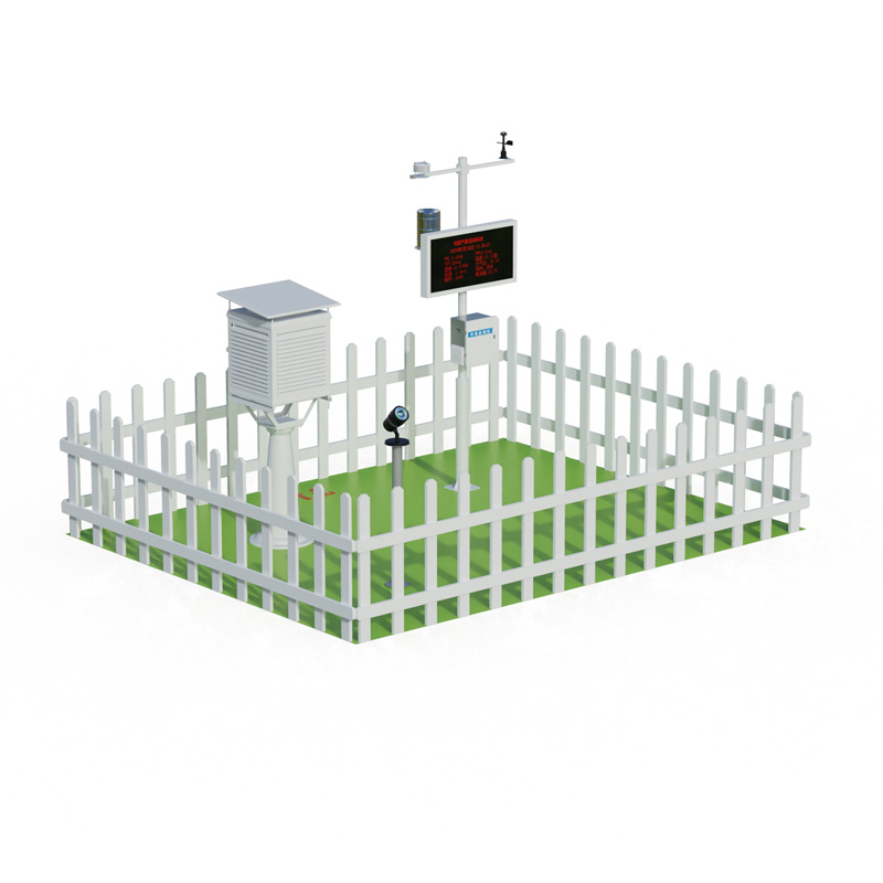
The operation of air quality monitoring stations relies on a comprehensive grid-based environmental supervision system. This system takes towns, communities (and villages) in cities as basic units, and divides them into air pollution prevention and control management grids according to different lev...
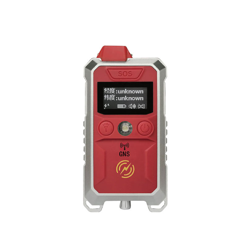
The water and rainwater detection equipment, namely the Water Level Monitoring System, can efficiently and accurately obtain data such as water level, flow rate, and rainfall.The Water Level Monitoring System is a fully automatic hydrological online monitoring system based on microwave technology. I...
In numerous meteorological monitoring and related fields, accurately measuring wind speed and direction is of great significance. From the perspective of large-scale meteorological research, understanding accurate data of wind speed and direction helps meteorological departments better predict weath...
Ultrasonic resonance anemometry is a commonly used meteorological observation technology. Its principle is to utilize the propagation characteristics of ultrasonic waves in the air to measure wind speed and wind direction. When sound waves propagate in the air, their speed will be affected by the wi...


 Skype
Skype
 whatsapp
 mail
mail