Tianyi Sensor IOT Technology Co., Ltd
Sales Manager:Ms. Emily Wang
Cel,Whatsapp,Wechat:+86 15898932201
Email:info@fengtutec.com
Add:No. 155 Optoelectronic Industry Accelerator, Gaoxin District, Weifang, Shandong, China


Sales Manager:Ms. Emily Wang
Cel,Whatsapp,Wechat:+86 15898932201
Email:info@fengtutec.com
Add:No. 155 Optoelectronic Industry Accelerator, Gaoxin District, Weifang, Shandong, China
time:2026-04-24 10:57:51 source:Weather Station viewed:4 time
Underwater Rescue Robot is equipped with a high-definition camera and imaging sonar, capable of transmitting real-time underwater footage back to the surface control station via either tethered or autonomous modes. With a maximum operational depth exceeding 300 meters, and outfitted with lighting and a manipulator arm, it is ideally suited for the rapid localization and recovery of underwater targets across various bodies of water—including oceans, reservoirs, rivers, and lakes.
Underwater Rescue Robot is an intelligent device specifically designed for underwater search and rescue (SAR), exploration, and observation missions. Utilizing its high-definition camera, the device transmits live video feeds or still images of the underwater environment back to a surface control terminal. This allows SAR personnel to analyze the transmitted imagery to assess underwater conditions, thereby effectively reducing search times and significantly increasing the success rate of rescue operations. The device is widely applicable across diverse aquatic environments—from oceans and reservoirs to rivers and lakes—enabling it to perform routine underwater environmental surveys as well as rapidly locate victims during critical emergencies, such as persons falling overboard or bridge collapses.
In terms of hardware architecture, Underwater Rescue Robot primarily comprises three core components: the underwater vehicle unit, the surface control station, and a hybrid electro-optical umbilical cable. The underwater vehicle unit is outfitted with a high-definition underwater camera, a multi-beam imaging sonar, LED lighting arrays, and a propulsion system. The forward-facing camera features a 2-megapixel digital HD network sensor with a minimum illumination rating of 0.01 lux, enabling it to capture clear imagery even in extremely low-light underwater environments; two front-mounted 50W LED lights ensure that the camera maintains full operational visibility even in completely unilluminated underwater zones. The propulsion system typically consists of 4 to 6 brushless thrusters—including both horizontal maneuvering thrusters and vertical lift thrusters—enabling multi-degree-of-freedom motion control, such as forward/reverse movement, lateral strafing, vertical ascent/descent, and stationary rotation.
The synergistic operation of its acoustic and optical systems constitutes the core technological foundation of Underwater Rescue Robot. In bodies of water with high visibility, the high-definition camera directly captures images of the underwater environment and transmits them in real-time, allowing operators to identify targets based on the visual feed. In turbid waters, a multibeam imaging sonar detects the location, shape, and distribution of underwater objects by emitting sound waves and receiving the resulting echoes, offering a visual range of up to 40 meters. Operators first use the sonar system to lock onto a target area; once the robot maneuvers close to the target, it switches to a forward-looking camera for further verification. The combination of these two technologies endows the device with rapid positioning capabilities, even in murky environments.
Replacing human divers in high-risk missions constitutes the core value of this device. In traditional underwater search and rescue operations, divers face a host of risks, including decompression sickness, drowning, exposure to extreme cold, and immense psychological and physiological stress. Underwater robots can step in to perform missions in complex and hazardous waters—such as reservoirs and river channels—thereby sparing human rescuers from danger. Furthermore, the cost of a single operation has plummeted from thousands of yuan to less than one hundred. During practical field exercises, traditional methods failed to locate a target within 90 minutes at a depth of 6 meters, whereas the underwater robot achieved precise localization in just 8 minutes. This device has already been deployed by emergency management agencies across various regions, where it is utilized for complex missions such as retrieving personnel from submerged karst caves at depths of up to 120 meters, clearing entanglements from ship propellers, and scanning underwater topography.
Driven by the continuous iteration of acoustic sensing technologies and AI recognition algorithms, the Underwater Rescue Robot system is now capable of autonomously adjusting its movement posture based on water currents, planning optimal search paths, and transmitting real-time maps of the underwater terrain—thereby significantly enhancing both the response speed and operational precision of emergency rescue efforts in complex aquatic environments.
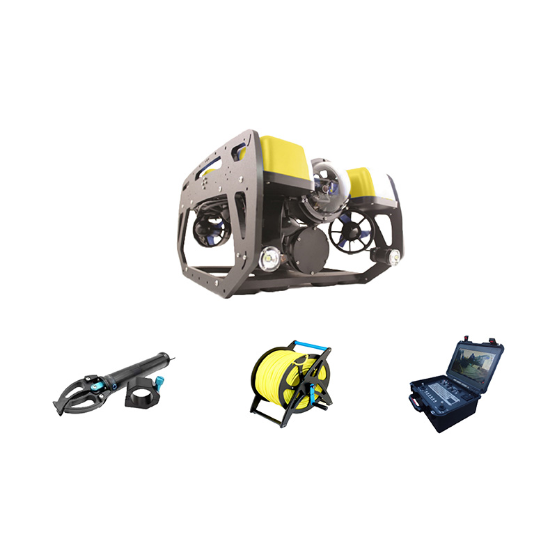
Underwater search and rescue robot is a high-performance underwater detection device integrating sonar scanning and high-definition video imaging. It uses sonar for large-area scanning and positioning, combined with high-definition video for detailed observation, providing scanned and 3D views of riverbeds and water bodies. It accurately identifies the outlines and locations of underwater targets and is widely used in underwater surveying and exploration....
Miniature rain gauge is a device that uses a PVDF piezoelectric film as the core rain-sensing component and integrates an embedded AI neural network algorithm to distinguish raindrop signals. It can remotely measure precipitation, precipitation intensity, and the start and end times of rainfall, achieving real-time and accurate measurement. It is widely used in meteorological monitoring and agricultural irrigation....
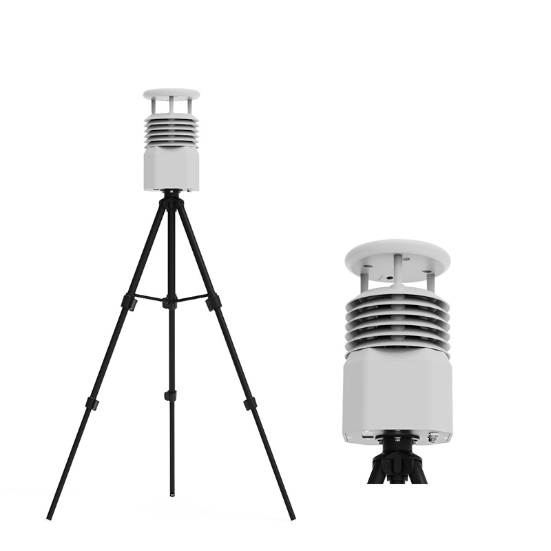
Traditional weather stations mostly use mechanical devices such as wind speed and direction indicators to measure meteorological elements. These devices have some limitations. For example, mechanical components are prone to wear and icing, requiring regular maintenance and calibration. Moreover, the...
Global Navigation Satellite System (GNSS) is an autonomous, worldwide space-based positioning system. These systems continuously broadcast radio navigation signals to the ground through satellite constellations, providing users with positioning, navigation, and timing services.01 GNSS Technica...


 Skype
Skype
 whatsapp
 mail
mail